Scots History to 1400
By Michael Lynch
This is a section from the book "Scotland: a New History" by Michael Lynch which covers Scottish history from the earliest times to the present. There is an Index page of all the sections of the book up to the end of the 14th century which have been added to Rampant Scotland. The pages were previously part of the "Scottish Radiance" Web site.
Roman 'Conquest', Occupation and Withdrawal

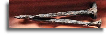
2,000 year-old Roman Iron nails from
Ichtuthill FortSuccessive Roman attempts to cope with the difficulties of Caledonia's geography are instructive. The three major sets of campaigns, beginning with Agricola's in AD 79-83, reveal a series of shifts in strategy. Between 79 and 80 he established a chain of forts in the valley between the Forth and the Clyde, which was already recognised as a potential frontier line. After his campaign of 83 into the far north-east, his successor, whose name is unknown, extended the chain of roads and forts south of but parallel to the diagonal line of the Highlands, extending deep into Strathmore. The hub of this northern complex was Inchtuthil, a fort for a full legion of some fifty-three acres, on the Tay. Within a year, however, Inchtuthil was abandoned and the Roman army fell back to a natural line of defence, the River Earn. [When it was excavated in the 1950s a large pit was found containing more than 750,000 iron nails and other iron objects weighing a total of ten tonnes, known as the "Inchtuthil hoard". The pit was elaborately concealed, and the nails and ironwork were almost certainly buried by the troops to deny them to the local tribes when they dismantled the fortress before they finally left. Several thousand of the nails were sold to raise funds for further work on the site The graphic here is of two of these nails - Ed].
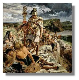
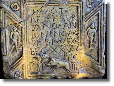
The strategy of having advanced forts as fire-breaks, to dampen native insurrections, was abandoned in AD 87 in favour of the quite different device of the construction of a permanent barrier to separate what were probably client peoples from the more hostile tribes beyond. This was the rationale behind Hadrian's Wall (pictured on the left), a seemingly formidable barrier of stone and turf twenty feet high and ten feet deep, built some thirty years later in 118. Yet this, the most obvious monument to the Roman presence north of the Humber, was laid up as near-obsolete within twenty years. The same strategy was adjusted to produce a wall further north on a more natural frontier line, between the Forth and Clyde: the Antonine Wall, built of turf on a base of sandstone boulders in 142-3, stretched for thirty-seven miles rather than eighty and had eighteen forts rather than one at every mile. This time more emphasis was placed on forts built beyond the wall to protect its flanks, like that at Duntocher at its western end and Bertha at its eastern edge, which lay as far north as the Earn. Again within a short space, between 155 and 161, the entire system was in turn abandoned, reoccupied and refurbished, and abandoned again as part of a strategic withdrawal to a re-equipped Hadrian's Wall. The Roman occupation of the south-eastern part of Caledonia beyond the Forth had lasted only five years.
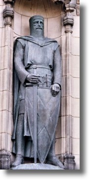
Until AD 207 the only active signs in a new policy of containment by a chastened army of occupation were modest attempts made to patrol the potentially hostile territory between the southern wall and the Cheviots. The ambitious and expensive campaign conducted by Emperor Septimius Severus (pictured on the right) in 209 resulted in treaties with the native tribes and gave him the title of 'conqueror of Britain' but no conquest of Britain was more short-lived than this. Shortly after 211, when Severus died at York, an ambitious new fort at Carpow, near Newburgh on the southern side of the Tay - which was, it has been argued, a new Inchtuthil - was abandoned. The first attempt to create a pale between Hadrian's Wall and the Antonine Wall was more or less at an end, in the face of what was the opposition of perhaps the first confederation of Pictish peoples south of the Mounth. After 215 a few forts were maintained north of Hadrian's Wall and the valleys beyond it were patrolled. A punitive expedition somewhere to the north of Hadrian's Wall was led by Emperor Constantius Chlorus in 306, but Rome was clearly on the defensive throughout the third and fourth centuries, relying on a combination of the strategies of a permanent barrier and a pale, now minimally patrolled. By 367 there are accounts of Hadrian's Wall being overrun. Two years later the forts to the north of it were abandoned, as was the Wall itself c.400. In the face of increasing seaborne attacks by both Picts and Irish on the Roman southern province, Hadrian's Wall by the mid-fourth century had become expensive to maintain and obsolete.
The reasons for the Romans' failure to conquer the north have been the subject of fierce debate. But the case for the defence and the rival, Pictish case for the success of the tribes in throwing off the yoke of Rome are usually directed at the non-conquest of the north rather than the Romans' failure to guard the pale they tried to create between the walls. It seems plausible that revised priorities, which demanded that troops be sent to the Danube in AD 83, may have been what brought to an end the Agricolan experiment. And it may be that the withdrawal after the death of Severus stemmed from a failure of will rather than a lack of military capability. Both explanations may miss the essential point. It had not been the facts of geography, both north and south of Antonine Wall. Southern governments as late as the reign of Elizabeth I would strive in vain to contain the stem of natural currents of trade, culture and aggression which united a highland zone inconveniently traversing a largely artificial frontier line. The Scottish 'borders' were immediate neighbours of England's northern highlands, which posed their own problem of order for central authority. And to underscore the fact that governments seldom learn from history, one exasperated Elizabethan border official in the 1580s suggested a new Roman wall, to keep out the Scots.
The effects of the uneven waves of Roman occupation between AD 79 and 215 are difficult to measure. Most Roman forts were probably quickly overgrown and forgotten, but some parts of their road system were still in use ten centuries later: Robert I in 1314 waited at Stirling for the progress of the English army of Edward II up Dere Street. Roman finds from non-Roman sites beyond the Antonine Wall, whether of the first or second century, are sparse and, north of the Mounth or north and west of the Great Glen, rare. Further south, Roman imprints are heavier but concentrated in certain areas: finds stray only rarely away from the upper part of the Firth of Clyde, the line of established roads such as Dere Street or the western route, which linked Carlisle with Cadder, near the western edge of the Antonine Wall. The impact of Roman withdrawal was obviously greater from the more regularly occupied zone south of the Forth, but its effect may have been more lasting on the local economy than on tribal politics. If the elaborate communications network between the two walls, with three cross-routes running east/west between the two main roads which connected the walls, had encouraged extensive civilian settlement, as at Cadder and Inveresk, it is difficult to imagine that these centres of trade or industry survived the withdrawal of the army. Not only Roman camps and forts were deserted: within fifty years the site of Traprain Law was abandoned by their client tribe, the Votadini. At Inchtuthil, the Roman legion left behind it almost one million unused nails, carefully hidden below the floor of a workshop. At Traprain Law the Votadini buried a silver hoard, which probably represented some of their income as Roman clients. By contrast, less spectacular finds of both native and imported metalwork in Berwickshire, Roxburghshire and Kirkcudbrightshire, all in the immediate shadow of Hadrian's Wall, hint at a tasting legacy in the pattern of rural settlement and farming rather than a traumatic break about 400. Overseas trade may well have disappeared for centuries, but the finds of bridle, harness, ploughshares, sickles and other implements suggest a legacy of working habits and labour skills less easily displaced or forgotten.
More difficult still to assess is the legacy of Roman Christianity. If Ninian's mission to an already Christianised south-west centred on Whithorn can be dated to the second half of the fifth century, a strong element of continuity must have existed there, made more tangible by the fact (for such are few and far between) that he trained in Gaul, perhaps before AD 450. Sea routes to Gaul and other parts of the Continent from the south-west may have survived, though there is little by way of evidence to show what passed along them. Between the Roman evacuation and Adomnan's Life of Columba, which sketches a brief glimpse of a cohesive people ruled over by typical Dark Age kings in the late sixth century, there is very little evidence on which to draw. The Novantae of Galloway are the most mysterious of the many early peoples of Scotland. The enigmatic Ninian is one of the few markers in an otherwise barren historical landscape. The historical understanding of early Scotland suffers greatly, it has been said, from the 'immense distortion' caused by this gap in the evidence between the end of the second century and the sixth. The best solution to the problem is a simple one: it is the leap in the mind rather than the hope of new, unexpected archaeological finds which will bring us closest to Dark Age Scotland.
Return to Index of Scots History to 1400
Where else would you like to go in Scotland?

